


Precision Thermal Imaging for Hunting & Leisure: Premium European Solutions for ...
The Hunting & Leisure market is evolving—driven by advanced technology, changing regulations, and the expectations of a new generation of responsible hunters...

September 04, 2019 . 5min read
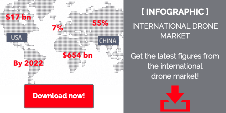
Professionals in the defense and security industries are well aware of the growing drone market. Drones are commonly used for military reconnaissance and civil defense. However, what about professional-grade civil drones? The market is booming, but as it has not yet reached maturity, it is difficult to measure. The most widely-accepted forecasts indicate that by 2022 this high-potential market could be worth $15 billion and demand is only expected to grow.
So, what does the drone market look like today? And how is thermal imaging making inroads into this market?
What is a drone?
Video footage and photos taken by hobby drones are now commonplace, so most people basically know what a drone is. However, professional-grade civil drones do have slightly different specifications:
A booming market
New uses
Drones equipped with thermal cameras are here, and they are currently used for things like measuring heat loss or pinpointing sources of heat in a variety of situations. This is known as “aerial thermography” and is mainly used to find out where something is not working correctly.
New advances in technology
The primary use of civil drones is to provide live video footage and still images using regular cameras. Thermal imaging is a useful addition to a drone, as it can expand the drone’s usage to the situations discussed above. Visible light and thermal imaging combined with a drone’s ability to go anywhere make for a great tool for fast, comprehensive thermal diagnostics.
The viewpoint chosen for a thermal measurement can be identified immediately, and can be used to rapidly and accurately determine the area to be covered and pinpoint any anomalies (heat losses, faulty insulation, or abnormally high energy consumption, for example), which will be clearly visible in the thermal image. Unlike other methods, thermal measurements are non-intrusive and do not impact operation of the facility being inspected. Finally, thermal cameras deliver extremely detailed images across a wide range of temperatures.
New savings for users
As the way people work changes, with different tasks completed by staff on the ground, by helicopter, or using satellite images, for example, drones will save both time and money. Drones can complete a thermography mission in half the time people on the ground can. Drones can also generate productivity gains of 80% (in man-days) for cartography and topography applications. Drones equipped with high-resolution cameras can rapidly cover heat and other networks rapidly and cost-effectively, providing high-quality information.
An evolving regulatory environment
One current stumbling block to the wider-spread use of civil drones is the regulatory environment. There is a lot of red tape and the rules vary from one country to another. France and the United States, two of the most promising markets for civil drones, still have fairly limited regulations:
- All flights must be filed with the relevant authorities prior to the flight
- Drone users must possess an unmanned aircraft pilot’s license
- Night flights are prohibited (unless special authorization is obtained)
The civil drone market is growing rapidly, and appropriate regulations will provide additional traction. In particular, integrating drones into air traffic control systems, removing altitude limits, and streamlining reporting and licensing requirements will all support growth. Investment in R&D in this high-tech industry will also promote growth.
The last word? The opportunities for thermal imaging on the growing drone market will only continue to expand! To learn more, download our infographic.

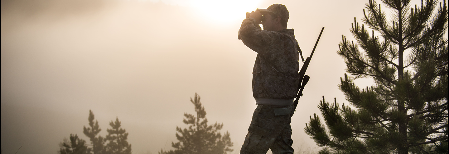
The Hunting & Leisure market is evolving—driven by advanced technology, changing regulations, and the expectations of a new generation of responsible hunters...

Propelled by advancements in imaging technology and increasing demand across various industries, the global short-wave infrared (SWIR) market has grown rapidly in recent years—a trend expected to continue...

Surging atmospheric concentrations of methane – which account for nearly one-third of global warming – have lifted this main constituent of natural gas to the No...

The health pandemic has been sending shockwaves across the global economy ever since the crisis struck two years ago, and the aftershocks have brought unprecedented changes and upheaval for both individuals and organizations around the world...

The detection of pedestrians at night is a crucial issue for road safety. 88% of pedestrians move on poorly maintained roads, lacking sidewalks, safe crossings, or lighting, where vehicles often travel at speeds exceeding 60 km/h...

Procurement divisions have always played a key role in industry, whereas the strategic value of an organization's relationships with its external stakeholders, especially its suppliers, has often flown under the radar...